Kalalau Trail to Hanakāpīʻai
The first two miles of the Kalalau Trail from Kēʻē to Hanakāpīʻai Beach, about 4 miles round trip. Hanakāpīʻai Falls is a longer inland extension.
Getting there
Advance Hāʻena State Park reservation required for non-residents.
Day-use hiking to Hanakāpīʻai has reopened. Check park entry requirements and same-day conditions before going.
Choose shuttle and entry, parking and entry if driving, or entry only for an eligible arrival without parking. Kēʻē Beach and the Hanakāpīʻai day hike use the same park reservation. Official rules
Plan B: If access changes, consider this other outing on Kauaʻi. Ke Ala Hele Makālae (Kapaʻa Coastal Path). Check its access and weather first. If weather is hazardous, skip outdoor alternatives.
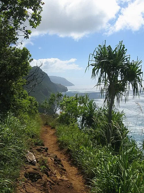
Day-use hiking to Hanakāpīʻai has reopened. Check park entry requirements and same-day conditions before going.
Plan your visit
For both routes, start hiking at signed Kēʻē trailhead: it is about 0.33 mile on foot from the Hāʻena State Park entrance parking lot and shuttle drop-off. For nonresident drivers reserve Parking + Entry in advance and stay within your reserved time slots. Hawaiʻi residents with valid state photo ID can use limited first-come parking; nonresident passengers still need Park Entry reservations. Entry Only does not authorize parking, and no roadside parking outside the park is allowed for park visitors. If riding, reserve Shuttle + Entry from Waipā Park & Ride; parking there is for shuttle customers. The Princeville Makai Golf Club stop is walk-up only, with no parking provided. Confirm the latest return time before departure. Do not cross rising, fast or muddy streams. Avoid swimming at Hanakāpīʻai Beach; the surf and currents can be dangerous. Download the official map and save your reservation before leaving; cell service at the park is unreliable.
Compare: Hanakāpīʻai Falls via Kalalau Trail.
Trail details
- Difficulty: Strenuous
- Route distance: 4 miles round trip
- Duration: About 3–4 hours from Kēʻē trailhead
Distances refer to the route described above. Check posted access and conditions.
Interactive trail map
Follow the highlighted route from the public trailhead to hanakāpīʻai Valley junction near the beach. Select a pin or use the zoom controls for detail.
The solid line stops at the mapped valley junction near the beach; it does not continue west on the permit-only Kalalau Trail or plot an informal path to the sand. Follow posted route signs and do not enter fast or rising water.
If the interactive map does not load, use the trail guidance and links on this page.
Dashed line: Walk from the park entrance lot or shuttle drop-off to the Kēʻē trailhead; Go Hāʻena estimates about 0.33 mi each way, separate from the hike mileage.
Route data © OpenStreetMap contributors (ODbL). Route and access reviewed 2026-11-17. Follow posted closures and trail signs.